







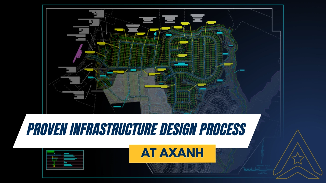
A disciplined Infrastructure Design Process does more than produce drawings. It creates a traceable path from raw site information to coordinated documentation that can support client review, regulatory coordination, pricing, and construction planning.
In land development and civil infrastructure work, expensive problems often begin before construction. They can start when survey coverage is incomplete, grading is developed without considering drainage behavior, utility routes are introduced too late, or technical drawings advance without a shared design baseline.
At AXANH, the project delivery workflow is organized to reduce that fragmentation. From the initial review of site data through multidisciplinary coordination and document production, each stage is intended to clarify assumptions, connect technical decisions, and make unresolved issues more visible before they move downstream.
For land developers, owners, engineering consultants, architects, contractors, and project managers, an effective Infrastructure Design Process is not simply a sequence of drafting tasks. Depending on the agreed project scope, it can include design production, modeling, engineering support, coordination, and documentation as part of the client’s broader engineering delivery process. Professional review and approval remain with the appropriately licensed responsible parties where required.
What Makes an Infrastructure Design Process Effective?
An infrastructure design process is effective when it converts survey information, site constraints, planning requirements, roadway geometry, grading criteria, drainage systems, utility inputs, and documentation standards into a sequence of connected design decisions.
In a land development project, each technical layer affects another. Roadway profiles influence adjacent finished grades. Finished grades affect utility cover and service connections. Utility alignments influence storm sewer routing. Stormwater performance depends on both surface grading and underground conveyance. Site layouts must also account for access, earthwork, serviceability, maintenance, and applicable approval requirements.
For this reason, AXANH approaches infrastructure work as an integrated delivery workflow rather than a collection of independent production tasks.
- Source data should be checked before it becomes design input.
- Assumptions should be recorded and clarified before they spread across multiple drawings.
- Discipline interfaces should be reviewed while alternatives are still practical.
- Deliverables should communicate design intent consistently across plans, profiles, notes, and details.
The value of this workflow is not simply faster production. It is greater visibility into the basis of design, the dependencies between disciplines, and the issues that still require client, authority, utility owner, or Engineer of Record input.
Why a Structured Workflow Matters in Land Development
Infrastructure projects become vulnerable when technical decisions advance in isolation. A team may begin with a topographic survey, develop a site layout, prepare grading, route utilities, and design stormwater systems. Each drawing may appear reasonable on its own, while the combined package still contains conflicts at the interfaces.
Typical issues include unclear project limits, inconsistent base files, impractical earthwork, drainage paths crossing utility corridors, roadway profiles that do not support adjacent grades, late retaining-wall requirements, and drawings that require repeated interpretation during technical review.
Progressive design reviews are widely used to move projects from early development toward final documentation. The FHWA project development workflow provides a highway-specific example of phased review at defined design milestones. The applicable stages, submission requirements, and approval responsibilities for an AXANH project are determined by the client, project type, and jurisdiction.
AXANH applies the underlying delivery principle at project level: each stage should resolve specific questions, identify remaining dependencies, and establish a clearer basis for the next design decision.
Design quality begins before the first sheet is issued
Quality is influenced by how information is received, named, checked, modeled, communicated, and reviewed. A final drawing check remains important, but it cannot compensate for unclear inputs, unmanaged assumptions, or disconnected design development.
This discipline is particularly important for distributed project teams. Clear file structures, recorded decisions, defined review points, and consistent handovers help team members work across organizations, locations, time zones, and technical standards without relying on informal knowledge.
Seven Connected Stages in AXANH’s Infrastructure Design Workflow
The sequence below represents a general AXANH delivery framework. It is adapted to the agreed scope, available information, client standards, jurisdictional requirements, project phase, and the responsibilities assigned to each project participant.
Stage 1: Project Intake and Raw Data Review
The process begins with a review of the information supplied by the client. Depending on the project, this may include topographic survey files, existing contours, boundary data, preliminary planning concepts, utility records, project limits, environmental information, authority comments, and client-specific criteria.
This stage is more than a file handover. The team considers which information can be used directly, which assumptions should be documented, and which gaps require clarification before design development proceeds.
- Confirm project limits, coordinate systems, survey coverage, and available reference files.
- Review contours, apparent drainage patterns, slopes, and visible physical constraints.
- Identify mapped wetlands, watercourses, low areas, high areas, and other sensitive features where relevant.
- Compare preliminary planning concepts with the available terrain and access information.
- Record missing inputs, discrepancies, and decisions that require client clarification.
The objective is to prevent uncertain information from being treated as confirmed design criteria in later layout, grading, drainage, roadway, or utility work.
Stage 2: Existing Conditions Plan and Surface Modeling
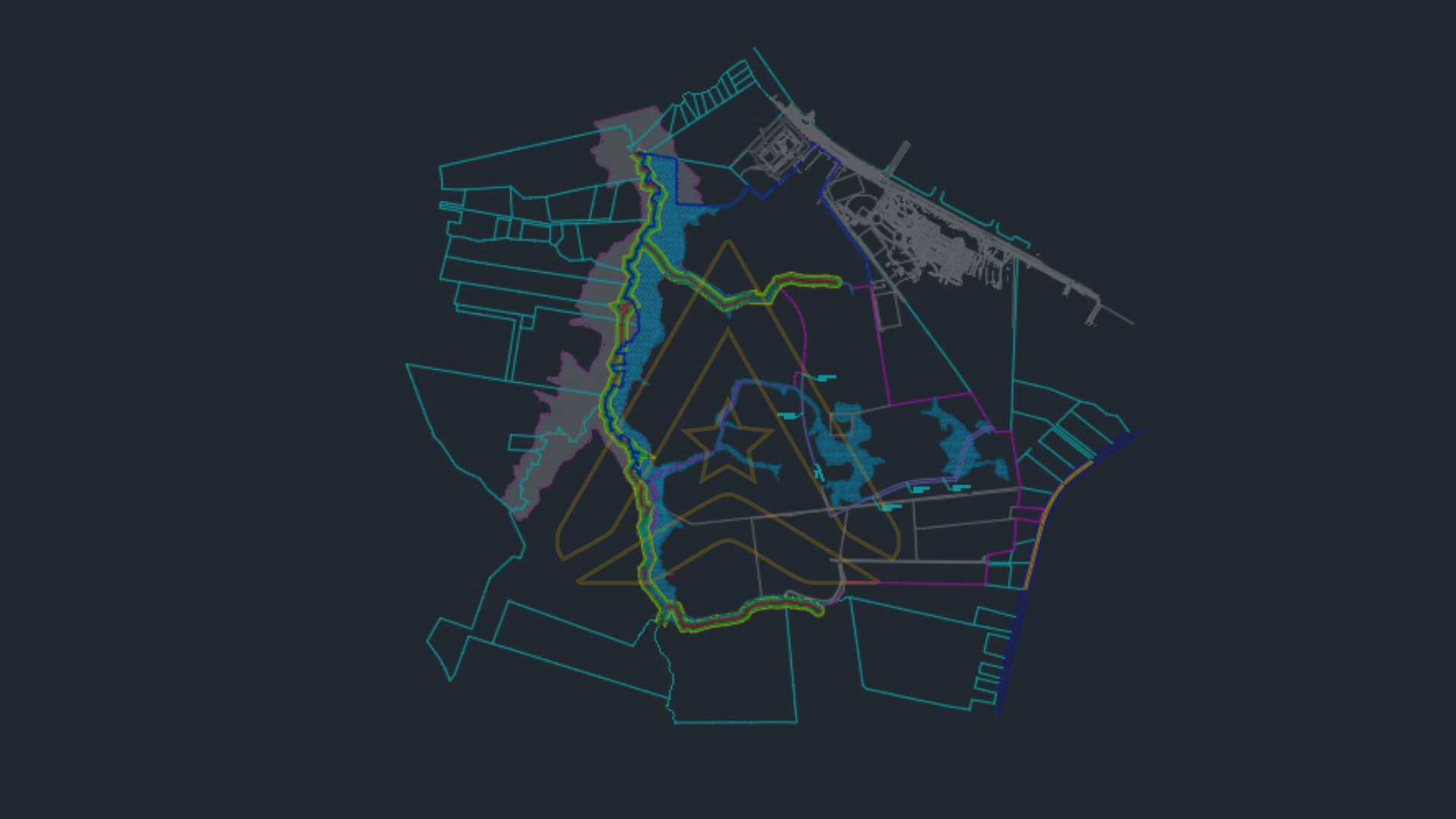
After intake, the available site information is organized into a common technical baseline. The Existing Conditions Plan and associated model provide a reference for subsequent layout, roadway, grading, drainage, and utility development.
Where included in scope, this stage may involve developing or checking an existing-ground surface from survey information. Digital civil design environments can support points, surveys, surfaces, alignments, profiles, corridors, grading objects, parcels, pipe networks, and plan production. Autodesk’s official Civil 3D tutorials provide technical background on many of these tools.
At AXANH, surface information is used as a design reference, not treated as an isolated modeling deliverable.
- Locate terrain high points, low points, breaks in slope, and potential overland flow routes.
- Identify areas that may be sensitive to ponding or require further drainage review.
- Consider terrain conditions that may constrain roadway alignment and profile development.
- Recognize areas where cut, fill, rock, soft ground, or retaining structures may affect the design.
- Review how existing elevations may influence utility depth and service connection concepts.
This is the point where source files begin to function as a shared engineering reference for the disciplines that follow.
Stage 3: Site Layout and Roadway Network Development
Once existing conditions are understood, AXANH can develop or refine the site layout and roadway network within the assigned scope. At this stage, planning intent is tested against terrain, access, drainage, utility, and constructability considerations.
A site layout must do more than arrange parcels, buildings, or circulation. It should be assessed against grading feasibility, roadway geometry, utility service concepts, drainage pathways, construction sequencing, and long-term access for operation and maintenance.
AXANH reviews the layout through practical engineering questions:
- Does the roadway network respond reasonably to the existing terrain and known constraints?
- Can proposed lots or development areas be served by the anticipated water, sanitary, stormwater, and access systems?
- Does the arrangement create avoidable grading, retaining-wall, or earthwork pressure?
- Are there feasible pathways toward the intended stormwater conveyance or storage areas?
- Can the layout support practical construction access, maintenance, and future operation?
Early layout decisions can influence much of the project’s downstream cost and technical complexity. Reviewing these relationships before the geometry becomes fixed preserves more opportunities for practical refinement.
Stage 4: Utility Infrastructure Coordination
Utility coordination is a sensitive part of infrastructure delivery because water, sanitary sewer, storm sewer, service connections, and related systems must work with roadway geometry, finished grades, drainage features, easements, and site constraints.
When utilities are added only after layout and grading have advanced, conflicts may be discovered after several dependent drawings require revision. AXANH therefore introduces utility considerations alongside surface design development, subject to the information and responsibilities included in the project scope.
The review may consider proposed connection points, alignments, service routes, pipe depths, slope requirements, crossing conditions, access for maintenance, and potential conflicts between systems. Record information and connection assumptions should be confirmed through client, utility owner, and authority input where applicable.
A coordinated Utility Plan does more than display linework. It helps project participants evaluate whether the proposed systems can be routed, accessed, and integrated with the surrounding surface design.
Stage 5: Grading and Stormwater Design Development
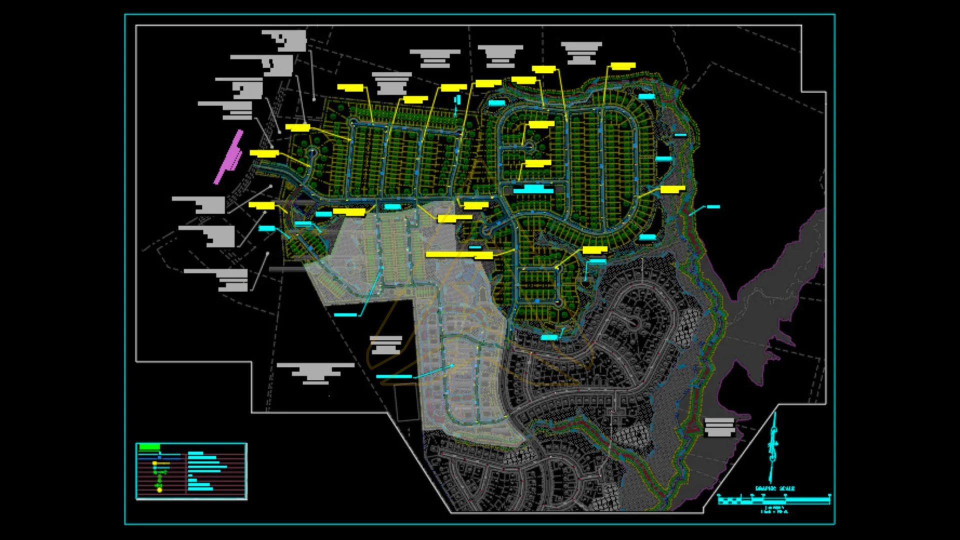
Grading and stormwater development establish how proposed surfaces, drainage pathways, conveyance systems, and storage areas are intended to work together. Depending on scope, AXANH may support finished-grade development, roadway profiles, pad elevations, overland flow routes, storm sewer layouts, and detention or retention concepts.
These decisions can affect earthwork, access, erosion risk, utility cover, retaining structures, and long-term drainage performance. Project-specific criteria and approval requirements vary by jurisdiction and remain subject to client direction and review by the responsible engineering professionals and authorities.
AXANH treats grading and stormwater as connected design workstreams. The objective is to develop a practical relationship between proposed elevations, drainage behavior, roadway access, utility requirements, and construction constraints.
- Develop finished grades that respond to drainage, access, and adjacent elevation requirements.
- Coordinate roadway profiles with site grading and anticipated utility depths.
- Review the relationship between surface conveyance, storm sewer systems, and storage areas.
- Compare cut-and-fill implications where the available model and scope support that assessment.
- Identify potential retaining-wall, erosion, tie-in, or localized drainage issues for further review.
Stage 6: Design Optimization and Alternative Evaluation
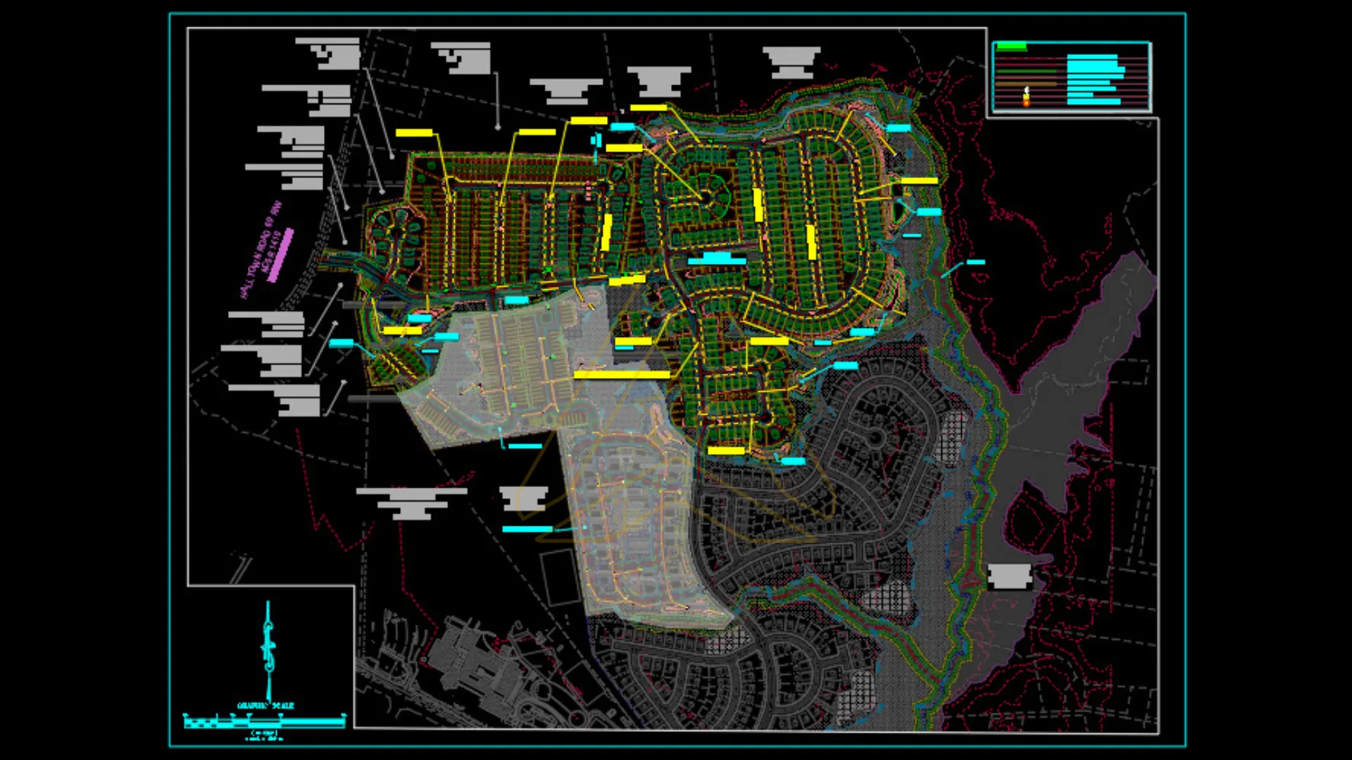
Infrastructure development is rarely a straight path from initial concept to final documentation. As the site is studied in more detail, a roadway may need to shift, a storage area may need to move, a utility corridor may require refinement, or proposed elevations may need to change.
AXANH uses alternative evaluation to compare practical options before one direction is advanced. The purpose is not unlimited iteration. It is to understand how each option affects technical performance, coordination, constructability, documentation, and known cost drivers.
- Cut-and-fill implications and areas of concentrated earthwork.
- Localized drainage behavior and the continuity of overland flow routes.
- Potential retaining-wall height, location, and construction access.
- Stormwater routing and storage efficiency.
- Utility crossings, cover, conflicts, and maintenance access.
- Roadway profile feasibility and connections to surrounding grades.
- Client priorities, review comments, project criteria, and downstream impacts.
This stage supports earlier, cost-aware decision-making. It allows the client and responsible project team to compare consequences while revisions remain more manageable than they would be during late documentation or construction.
Stage 7: QA/QC, Coordination Review and Technical Documentation
QA/QC should not be confined to a single final check. At AXANH, review activities are incorporated throughout intake, model development, discipline coordination, drawing production, and handover.
The documentation stage includes checks for drawing consistency, file organization, revision status, references, sheet-to-sheet alignment, annotation, and deliverable completeness within the agreed scope. The objective is to communicate design intent clearly to clients, consultants, reviewers, project managers, and contractors.
Where relevant to project standards, the United States National CAD Standard by NIBS provides a reference for consistently organizing and presenting facility drawing information. Actual project deliverables remain governed by the client’s CAD standards, contract requirements, applicable jurisdictional criteria, and the direction of the responsible design professionals.
Depending on the project scope, deliverables may include:
- Existing Conditions Plan.
- Site Layout Plan.
- Grading Plan.
- Storm Drainage Plan.
- Utility Plan.
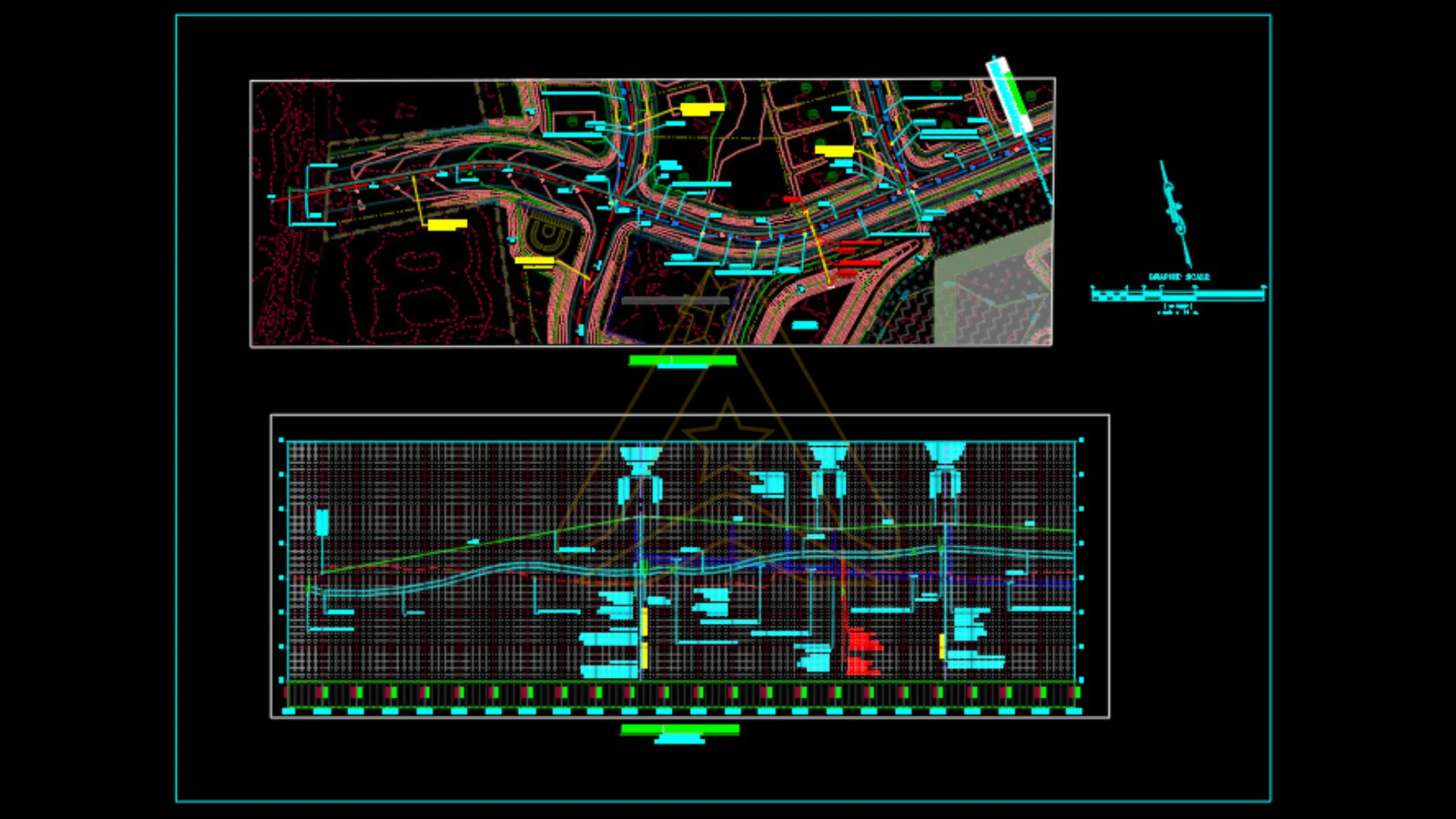
- Roadway Plan and Profile Sheets.
- Details, notes, legends, schedules, and supporting technical documentation.
The drawing set should function as one coordinated package rather than a collection of unrelated technical files. Where professional sign-off or permitting approval is required, the documents remain subject to review and approval by the designated licensed professionals and authorities.
How Coordination Protects Design Quality
Infrastructure projects require multidisciplinary coordination because changes in one workstream can affect several others. AXANH manages these interfaces through a shared project baseline, recorded assumptions, progressive review, and defined handover points.
| Workstream | Key Decisions | Coordination Risk | AXANH Control Method |
|---|---|---|---|
| Survey and Existing Conditions | Contours, site limits, control, constraints | An incomplete baseline can affect every later discipline | Input review, file standardization, discrepancy tracking, and clarification |
| Site Layout | Road network, development areas, access | The arrangement may not support grading, drainage, or utility service | Terrain, access, serviceability, and constructability review |
| Roadway Design | Alignment, profile, intersections, circulation | Vertical geometry may conflict with drainage or utility requirements | Integrated review against surfaces, adjacent grades, and utility corridors |
| Grading | Finished elevations, pads, tie-ins, earthwork | Excessive cut or fill, ponding, steep transitions, or retaining structures | Surface analysis, option comparison, and interface checks |
| Stormwater | Surface flow, conveyance, storage, discharge | Interrupted drainage paths or incompatible system components | Review with grading, utility routing, site layout, and applicable criteria |
| Utilities | Water, sanitary sewer, storm sewer, services | Crossings, insufficient cover, access limitations, or service conflicts | Plan and profile checks, connection review, and conflict tracking |
| Documentation | Plans, profiles, notes, details, revisions | Inconsistent information or unclear responsibility at handover | QA/QC, version control, coordinated sheet organization, and issue tracking |
This approach reduces isolated decision-making. Instead of allowing each technical layer to advance independently, the team reviews interfaces and dependencies so that conflicts can be identified, assigned, and addressed at an appropriate stage.
How Cost Awareness Is Built Into the Process
Cost awareness should begin while design options remain flexible. It is more difficult to improve a grading strategy, roadway profile, utility corridor, or stormwater arrangement after multiple documents and dependent decisions have already been completed.
AXANH supports cost-aware design development by drawing attention to factors that may influence quantities, complexity, sequencing, or rework. Examples include concentrated earthwork, inefficient drainage routes, retaining structures, utility conflicts, complex vertical geometry, and unclear documentation.
- Reviewing terrain and known constraints before the layout is fixed.
- Comparing cut-and-fill implications where sufficient model information is available.
- Identifying grading transitions that may create retaining-wall or access concerns.
- Coordinating drainage pathways with finished grades and utility corridors.
- Checking anticipated utility depths, crossings, and service routes during design development.
- Improving drawing consistency so that pricing, review comments, and construction questions can be addressed against clearer information.
This approach does not guarantee the lowest construction cost or eliminate design changes. It helps the project team make decisions with a clearer understanding of likely technical and cost consequences.
What Clients Receive at the End of the Process
The outcome of AXANH’s Infrastructure Design Process is a coordinated technical package developed through input review, modeling, design support, discipline coordination, option assessment, and QA/QC.
Subject to the agreed scope, the package may include an existing-conditions baseline, site layout plans, grading plans, storm drainage plans, utility plans, roadway plan and profile sheets, details, notes, legends, and other review or construction documentation support. Deliverables may be prepared for client review, coordination with the Engineer of Record, or submission within the client’s wider engineering process.
For owners and developers, the package provides a clearer view of the proposed design direction. For engineering consultants, it supports coordination and production capacity. For project managers, it creates a more traceable basis for tracking decisions and comments. For contractors, consistent plans and profiles can make the intended work easier to interpret during pricing and construction planning.
The value lies in traceable decisions
The deeper value is the connection between each stage. When assumptions, models, design decisions, comments, and revisions are managed consistently, the final package is easier to review, explain, update, and hand over.
When to Engage AXANH for an Infrastructure Project
AXANH is a suitable partner when a project requires more than isolated drawing production. The workflow is particularly relevant when clients need additional technical capacity supported by clear inputs, multidisciplinary coordination, QA/QC, and disciplined documentation.
- Greenfield or land development projects beginning with survey and preliminary planning information.
- Infrastructure work involving roadway, grading, stormwater, and utility interfaces.
- Projects where early geometric or elevation decisions may influence construction complexity.
- Engineering consultants managing workload peaks or documentation-intensive phases.
- Distributed teams requiring consistent communication, file management, and review workflows.
- Projects requiring defined QA/QC procedures and an organized technical handover.
AXANH’s role is not limited to drafting. Depending on the engagement, the company can support design production, modeling, technical coordination, documentation, and delivery governance as part of the client’s broader engineering process. To understand the wider foundation behind this approach, explore AXANH’s technical delivery capabilities and structured delivery model.
Discuss Your Infrastructure Delivery Needs with AXANH
Share your project stage, available site information, required deliverables, technical standards, and coordination needs. AXANH can then help define an appropriate scope for design production, engineering support, or documentation delivery.
Final Thoughts
Infrastructure design turns site information into a sequence of accountable technical decisions.
At the beginning, a project may contain survey files, planning objectives, physical constraints, authority requirements, utility information, and unresolved questions. As the design develops, these inputs should become a documented basis for layout, grading, drainage, roadway, utility, and drawing decisions.
AXANH’s Infrastructure Design Process connects raw data review, existing-conditions modeling, site layout, utility coordination, grading, stormwater development, alternative evaluation, QA/QC, and technical documentation. The purpose is to help clients see the relationships between disciplines and move each decision through the appropriate review process.
From Vietnam, AXANH supports international project teams with technical capability, delivery discipline, transparent coordination, and a long-term partnership mindset.
FAQ
What is the first step in AXANH’s Infrastructure Design Process?
The first step is project intake and source-data review. AXANH examines the available survey information, project limits, contours, planning concepts, utility references, known constraints, and client criteria to identify the confirmed inputs, assumptions, discrepancies, and missing information that may affect design development.
How does AXANH support cost-aware infrastructure design?
AXANH helps project teams identify design factors that may influence cost or construction complexity, including concentrated earthwork, difficult grading transitions, retaining structures, drainage routes, utility conflicts, and vertical-geometry constraints. This supports better-informed option assessment but does not guarantee a specific saving or eliminate later changes.
What documents are typically included in an infrastructure design package?
Depending on the agreed scope, a package may include an Existing Conditions Plan, Site Layout Plan, Grading Plan, Storm Drainage Plan, Utility Plan, Roadway Plan and Profile Sheets, details, notes, legends, and supporting documentation. Documents requiring professional approval remain subject to review by the designated licensed professionals and applicable authorities.
Why is multidisciplinary coordination important in land development?
Roadway design, grading, drainage, utilities, access, and site layout are interdependent. A change to one discipline may alter elevations, pipe depths, flow routes, crossings, or adjacent geometry. Progressive coordination helps the project team identify these effects before they spread across multiple drawings.
Is AXANH only a drafting provider?
No. Depending on the agreed engagement, AXANH can provide design production, civil modeling, engineering support, multidisciplinary coordination, QA/QC, and technical documentation as part of a client’s broader project delivery process. AXANH does not automatically assume Engineer of Record, professional sign-off, or approving-authority responsibility unless such a role is expressly established and legally permitted.
