
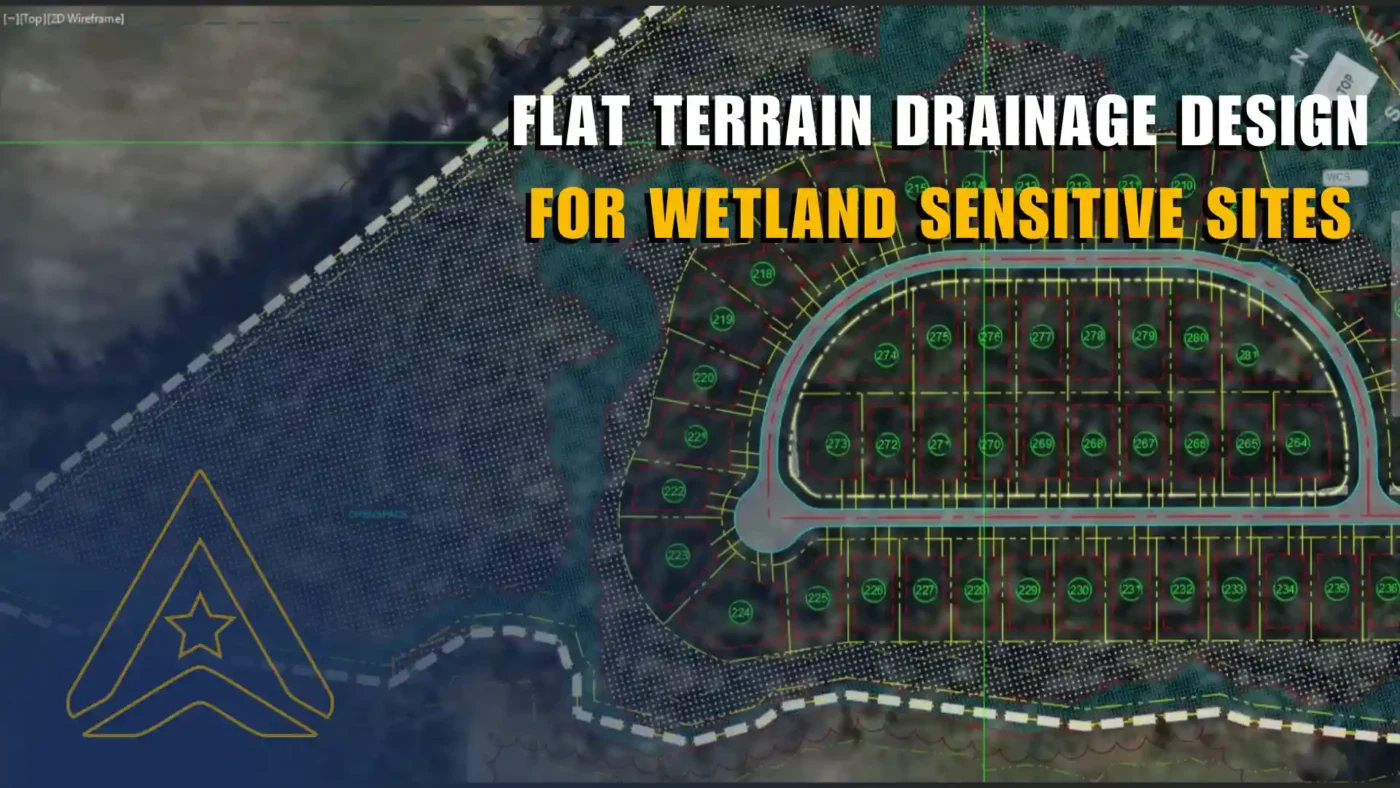
Flat terrain can look simple until the first drainage problem appears. With little natural slope, stormwater does not have an obvious path to follow. It may spread across shallow ground, collect at unexpected low points, or become trapped behind roads, pads, embankments and grading transitions. When wetlands, soft ground and natural discharge areas are part of the site, the challenge becomes less about “adding drainage” and more about designing an entire infrastructure layout that understands the land.
For AXANH, flat terrain drainage design begins with one principle: water movement, grading, roadway geometry and environmental constraints must be read as one connected system. A flat site cannot be solved by pipes alone. It needs a layout strategy that gives water a responsible direction without forcing the project against its natural conditions.
The real value of flat terrain drainage design is not only in preventing ponding. It is in helping project teams make better early decisions about layout, grading, wetlands, drainage corridors and constructability before conflicts become expensive to fix.
Why flat terrain drainage design creates hidden challenges
Flat terrain often appears calm. There are no dramatic slopes, no obvious ridgelines and no immediate terrain barriers. But that visual simplicity can hide a difficult design problem: gravity provides very little help.
In conventional drainage design, water moves from higher ground to lower ground through a clear slope relationship. On nearly flat land, that relationship is weak. A few inches of elevation difference can decide whether water reaches a ditch, remains at a low point, crosses under a roadway or spreads into a sensitive wetland edge.
The design challenge is not only hydraulic. It is also spatial, environmental and operational. The roadway network, grading surface, ditch alignment, culvert invert and discharge point all influence each other. If one of these decisions is made in isolation, the project can quickly create drainage conflict elsewhere.
- Limited natural slope makes gravity drainage difficult to control.
- Wetlands and low-lying areas reduce the freedom to reshape the site.
- Roadway embankments may interrupt shallow natural flow.
- Small grading changes can create large downstream consequences.
- Cut-fill balance becomes harder when positive drainage must be created artificially.
In flat terrain drainage design, the real problem is directionless water
On a low-slope site, water may not fail dramatically. It may fail quietly. It may remain along a roadside ditch with insufficient slope. It may pond between a roadway profile and a proposed pad. It may back up near a culvert because the outlet elevation was not coordinated early enough. It may be blocked by a road that was aligned before the drainage path was fully understood.
This is why flat terrain drainage design must start before the design becomes rigid. If the roadway layout is fixed too early, drainage may become a correction exercise. If wetlands are mapped late, grading options may narrow. If discharge points are considered only after the surface is modeled, the design may require avoidable rework.
The key insight is simple but often overlooked: on flat terrain, drainage begins with layout. Pipes, ditches and culverts are important, but they work best when the entire site has already been organized around a clear water movement strategy.
Wetlands change the design mindset
Wetlands are not empty land waiting to be filled. They can support water quality, habitat, floodwater storage and surface water flow. The U.S. Environmental Protection Agency describes wetlands as highly productive ecosystems and highlights their environmental importance in water and habitat systems. See EPA’s overview of why wetlands are important.
For infrastructure design, this means wetlands must be understood early. A responsible project cannot simply raise the entire site, cut deeper channels or redirect water wherever convenient. Instead, the design team must ask a better question: how can the infrastructure work with the natural drainage behavior of the site?
That question changes the role of the designer. The task is no longer to overpower the site. The task is to organize development around what the site is already telling us.
AXANH’s approach to flat terrain drainage design
AXANH starts by studying the existing site condition before locking in the infrastructure layout. The team looks for wetlands, shallow depressions, low ground, existing drainage corridors, soft soil zones and potential natural discharge points. These are not secondary details. They are the first layer of the design logic.
When this natural system is understood, layout decisions become more precise. Roads can be placed where they reduce drainage conflict. Ditches can follow practical corridors. Culverts can maintain cross-drainage continuity. Discharge points can become anchors for the overall strategy.
This is the foundation of AXANH’s flat terrain drainage design approach: read the land first, then organize the infrastructure around a drainage logic that can actually work.
Mapping what the site already wants to do
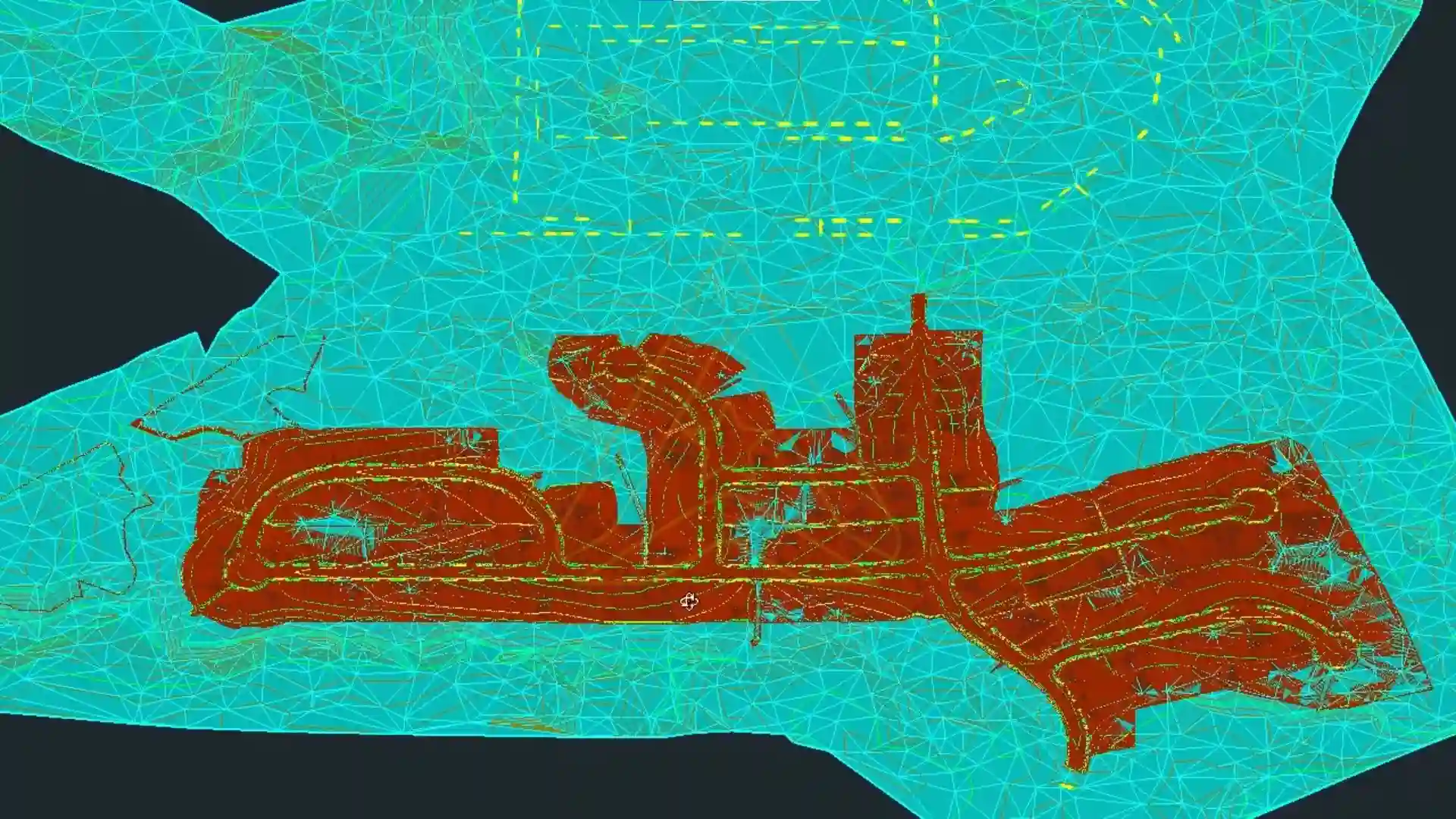
The first design layer is not the proposed roadway network. It is the existing hydrologic behavior of the land. AXANH studies where water naturally collects, where shallow flow paths appear, where wetlands begin, and where the site has realistic discharge opportunities.
This early mapping helps answer several critical questions:
- Where should infrastructure avoid unnecessary disturbance?
- Where can roads support drainage instead of blocking it?
- Which low areas are natural drainage features rather than problems to erase?
- Where should culverts preserve cross-flow continuity?
- Which discharge points can guide the larger grading strategy?
By reading the site this way, AXANH avoids treating drainage as a late-stage repair. Instead, flat terrain drainage design becomes part of the project’s first design conversation.
Using layout strategy in flat terrain drainage design
On flat terrain, layout is not just a planning decision. It is a drainage decision.
A roadway placed across a shallow natural flow path may require additional culverts. A development pad placed too low may create ponding risk. A layout that pushes too close to wetlands may increase environmental disturbance and approval pressure. A road profile that ignores downstream discharge may create a system that works in isolated pieces but fails as a whole.
AXANH uses layout strategy to reduce these conflicts before they become expensive. The goal is to align the development program, roadway network and drainage path into one coherent system.
| Design Layer | What It Influences | Why It Matters on Flat Terrain |
|---|---|---|
| Wetland boundary | Buildable area, grading limits, discharge options | It defines where the design must be more sensitive and less invasive. |
| Roadway network | Flow direction, ditch location, culvert crossings | Roads can either support drainage or interrupt shallow surface flow. |
| Grading surface | Low points, runoff path, cut-fill balance | Small elevation changes can affect broad areas when natural slope is limited. |
| Longitudinal ditches | Surface drainage collection and conveyance | Ditches create controlled corridors where the existing land has no clear flow path. |
| Culvert pipes | Cross-drainage continuity | Culverts help water pass beneath roads and embankments without trapping flow. |
| Natural discharge points | Overall drainage destination | They anchor the strategy and reduce unnecessary artificial intervention. |
How roadway networks support flat terrain drainage design
Roads are usually seen as circulation infrastructure. On flat terrain, they also become part of the drainage framework.
A roadway profile can establish high points, low points and longitudinal flow direction. Roadside ditches can collect runoff and carry it toward culverts or discharge points. Culverts can preserve natural cross-flow where the roadway interrupts existing shallow drainage.
This means roadway design cannot be separated from drainage design. AXANH reviews road alignment, vertical profile, ditch grades, culvert locations and discharge logic together. The question is not only whether a road can be built. The question is whether the road helps the site drain.
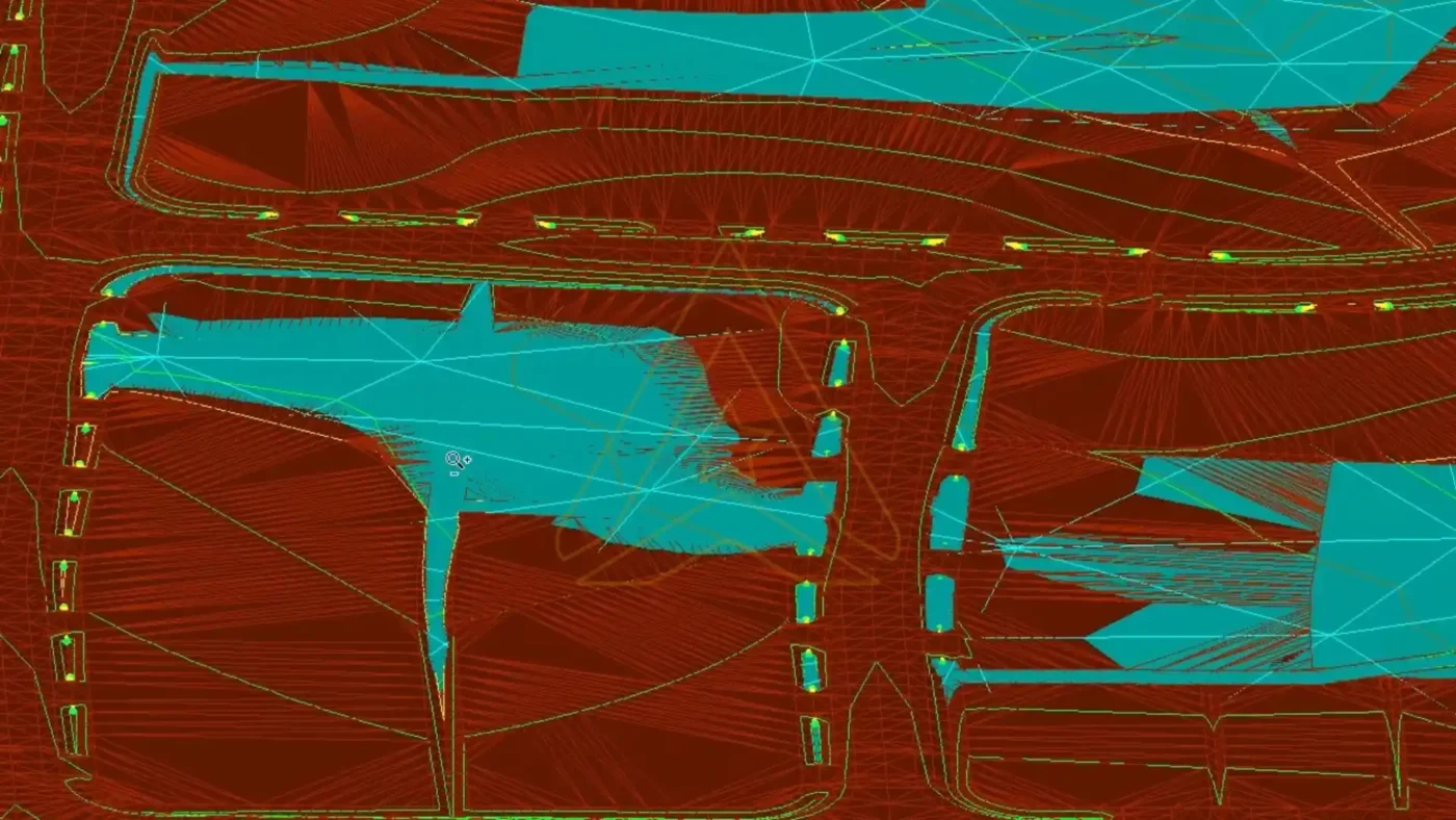
Longitudinal ditches as controlled drainage corridors
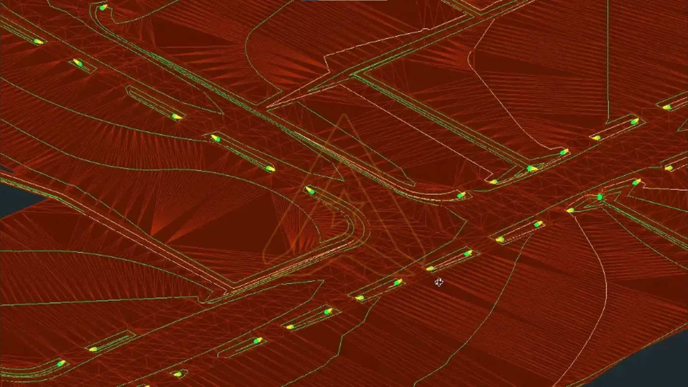
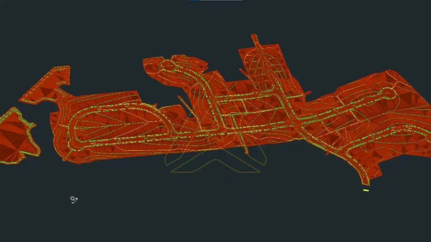
Longitudinal ditches are often essential on flat terrain because they provide a defined path where the existing land may not offer one. They can collect runoff along roadways, guide water through the project and connect drainage areas to culverts or discharge points.
However, a ditch is not automatically effective because it appears on a plan. It must have workable slope, a practical depth, a realistic outlet and a maintainable alignment. If the ditch is too flat, water may stand. If it is too deep, it may create constructability and maintenance issues. If it does not connect to a clear discharge point, it only moves the problem elsewhere.
For AXANH, ditch design is one of the key details that turns flat terrain drainage design from a concept into a buildable system.
Culvert pipes to preserve cross-drainage
On flat land, even a modest roadway embankment can interrupt shallow natural flow. Culvert pipes help preserve cross-drainage continuity by allowing water to pass beneath roads, driveways and embankments.
For roadway-related drainage systems, FHWA’s Urban Drainage Design Manual, HEC-22 provides a practical reference for storm drainage systems that collect, convey and discharge stormwater associated with transportation facilities.
On a flat terrain project, culvert placement must be carefully coordinated with inlet elevation, outlet elevation, pipe slope, cover, downstream conditions, roadway profile and wetland boundaries. A culvert is not just a crossing detail. It is a continuity decision.
Natural discharge points as the design anchor
A natural discharge point can become the organizing anchor for the entire drainage strategy. If runoff can be directed toward an existing discharge condition responsibly, the project may avoid excessive artificial intervention, reduce earthwork pressure and preserve more of the site’s natural logic.
Ignoring natural discharge points often creates unnecessary complexity. The design may need deeper ditches, longer pipes, more fill or awkward transitions. In wetland-sensitive areas, that can also increase disturbance and coordination risk.
AXANH studies discharge opportunities early so the project has a realistic drainage destination. From there, roadway-side ditches, culvert crossings and grading surfaces can be arranged to support the path of water.
Balancing drainage performance with cut-fill efficiency
Flat terrain drainage design is not only about hydraulics. It is also about earthwork.
To create positive drainage on nearly flat land, the design may need subtle but widespread grading adjustments. If too much of the site is raised, fill volume can increase quickly. If too much is cut, ditches may become deeper than needed or difficult to maintain. If grading is minimized too aggressively, drainage performance may remain weak.
This is why AXANH treats grading, drainage and cut-fill balance as a connected decision. The design must create enough slope for stormwater to move, but not so much intervention that the project becomes expensive, disruptive or difficult to build.
For related thinking on grading and earthwork decision-making, readers can explore AXANH’s insight on earthwork optimization for complex sites.
What AXANH reviews before the design hardens
AXANH reviews flat terrain grading through practical questions that connect design performance with constructability:
- Does the grading surface direct water toward a planned drainage path?
- Are low points intentional, controlled and connected?
- Do longitudinal ditches have enough fall to function?
- Are culvert inverts feasible with roadway cover and downstream conditions?
- Does the solution avoid unnecessary disturbance near wetlands?
- Does the design support a reasonable cut-fill balance?
This review mindset helps reduce late-stage rework. It also helps the project avoid overdesign. The best solution is not always the one that changes the land the most. Often, it is the one that understands the land best.
What flat terrain drainage design shows about AXANH
Flat terrain drainage design is a strong example of how AXANH approaches complex infrastructure challenges. The work is not only about preparing drawings. It is about helping project teams make better decisions earlier.
AXANH connects technical execution with practical design judgment. The team looks at layout, grading, road profiles, drainage paths, wetlands, constructability and documentation as one delivery system. That integrated thinking helps reduce avoidable conflict between design intent and project reality.
Integrated thinking across layout, grading and drainage
A flat terrain project cannot be solved one layer at a time. Layout, grading, roadway design, drainage design and environmental sensitivity must move together. When they do, the project becomes easier to coordinate, easier to explain and more likely to advance with confidence.
This approach connects with AXANH’s broader capabilities in technical documentation, digital delivery, QA/QC, workflow discipline and partner coordination.
Practical judgment for constrained sites
Every flat site is different. Some have wetlands at the boundary. Some have low areas through the center. Some have limited discharge options. Some have soft ground, shallow slopes or strict environmental constraints.
AXANH does not treat these conditions as reasons to delay design. They become the starting point for smarter design. The final solution may include longitudinal ditches, culvert pipes, adjusted road profiles, refined grading surfaces or a revised layout strategy. But each element must serve the same purpose: create a drainage system that works with the site.
See how AXANH approaches flat terrain drainage design in practice:
FAQ: Flat terrain drainage design
Why is flat terrain difficult for drainage design?
Flat terrain is difficult because stormwater has limited natural slope to follow. Without enough elevation difference, water may move slowly, collect in shallow depressions or become trapped behind roads and grading transitions.
How can drainage be designed without disturbing wetlands?
Drainage should begin with wetland mapping, low area analysis and natural flow path identification. The layout can then be adjusted to reduce unnecessary encroachment, while culverts and ditches help maintain controlled drainage continuity.
What role do longitudinal ditches play on flat sites?
Longitudinal ditches act as controlled surface drainage corridors along roads. They collect runoff and guide water toward culverts or discharge points when the existing land does not provide a clear flow path.
Why are culvert pipes important in flat terrain drainage design?
Culvert pipes help water pass beneath roads, driveways and embankments. Without culverts, shallow natural flow may be blocked, creating ponding and drainage imbalance.
How does AXANH balance drainage design and cut-fill efficiency?
AXANH coordinates grading, roadway profiles, ditch alignments, culvert locations and discharge points early in the design process. This helps create enough slope for drainage without unnecessary earthwork or avoidable wetland disturbance.
Designing where gravity gives almost no help
Flat terrain drainage design is not about forcing water through a site. It is about understanding how the site already works, then shaping layout, grading, ditches, culverts and discharge points into one coherent system.
When wetlands, soft ground, low-lying areas and limited natural slope are involved, the right design answer rarely comes from one isolated decision. It comes from coordination.
AXANH helps project teams approach these conditions with practical engineering judgment, digital workflow capability and a long-term partnership mindset. From Vietnam, AXANH supports global infrastructure projects by turning complex site constraints into clear, buildable and responsible design strategies.
Need a smarter flat terrain drainage design strategy?
AXANH supports grading, drainage and infrastructure layout coordination for projects where wetlands, low slope and constructability must be solved together.
